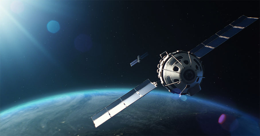
Disasters such as landslides, dam failures, and ground collapses often strike without warning, leaving devastation in their wake. However, with advancements in satellite technology, we now have a tool that can change this narrative. Interferometric Synthetic Aperture Radar (InSAR) offers a groundbreaking way to monitor ground motion and instability from space, providing critical early warnings before catastrophic events occur.
By analyzing subtle shifts in the Earth’s surface over time, InSAR helps detect risks that are invisible to the naked eye. This technology has already proven its worth in monitoring structures like tailings storage facilities, landslides, and mass urban deformation, identifying warning signs months—even years—before disaster strikes.
In this article, we’ll explore how InSAR works, its strengths and limitations, and real-world examples of how it can predict and potentially prevent natural and man-made disasters.
What is InSAR
Interferometric Synthetic Aperture Radar (InSAR) is an earth observation technique that uses radio waves sent and received by satellites to detect ground elevation changes. By comparing phase differences in signals from multiple satellite passes over the same area, InSAR can map ground deformation over time. As radio waves can penetrate cloud cover, InSAR will work no matter what the weather is like on the ground.
This method is effective for identifying both sudden events like landslides and slower changes that might threaten infrastructure. InSAR is increasingly used across industries, including mining, where it helps monitor tailings storage facilities (TSFs) for safety.
Davra Sentinel (opens new window) utilizes the Sentinel-1 SAR mission, a European Space Agency (ESA) and European Commission initiative capturing Earth images with a 5 x 20-meter resolution. With the launch of Sentinel-1C (opens new window) (December 2024) and the upcoming Sentinel-1D (2025), the mission will soon restore its full global coverage and reduce capture intervals from 12 to 5 days across most areas of the globe.
Davra Sentinel was developed in partnership with the European Space Agency, funded as part of the Incubed Program.
What does InSAR measure?
InSAR measures ground deformation in millimeters, presented as “Line-of-Sight” (LOS) from the satellite. Negative LOS indicates the ground is moving away from the satellite, while positive LOS means it’s moving closer. LOS represents a combination of East-West and Vertical movements, as North-South deformation cannot be detected due to Sentinel-1’s orbit.
Extracting precise East/West and Vertical movements requires both ascending and descending orbit images, which aren’t globally available yet but may become possible with future satellite constellations.
Sentinel monitors cumulative displacement, showing total ground movement since the first image in the time series. For instance, a +20 mm reading means the ground is 20 mm closer to the satellite compared to two years ago. Although measurements are relative, significant deformation events and long-term trends are still identifiable.
Wavelength & Resolution
InSAR uses radio waves of varying wavelengths, each with advantages and trade-offs. Shorter wavelengths provide better displacement resolution but lower coherence, making image comparisons less reliable. Longer wavelengths detect long-term deformation but offer lower resolution.
Four main wavelengths are used in InSAR: X (~3 cm), C (~6 cm), L (~24 cm), and P (~80 cm). Each suits different needs, with shorter wavelengths detecting small, short-term changes and longer ones capturing broader, long-term events.
Sentinel-1 operates on the C-band (~5.6 cm), known as the “workhorse wavelength.” It balances resolution and coherence, enabling the detection of small ground deformations over short periods without losing sensitivity to longer-term changes.
Join our Mailing List
Join thousands of professionals and get IoT tips to help you transform your business.

How Satellites Can Prevent Disasters
Satellites equipped with InSAR technology are revolutionizing disaster prevention by detecting ground motion and instability from space. By monitoring changes over time, they provide early warnings that can help mitigate risks and prevent catastrophes. We’ll look at two key examples that demonstrate the potential to detect and prevent environmental disasters before they happen.
Tailings Storage Facilities (TSFs)
Earthen dams, like those used for mine waste storage, can become unstable if not properly maintained, leading to breaches with devastating consequences. A tragic example is Brumadinho, Brazil, where a TSF collapsed on January 25, 2019, claiming over 250 lives and contaminating the nearby Paraopeba River.
Studies of this (opens new window) and similar events, such as the Jagersfontein tailings dam collapse (2022), show that early warning signs of ground deformation were present (opens new window) months before the failures. InSAR measurements taken during the year leading up to the disaster revealed significant deformation within the reservoir and consistent shifts across all sections, demonstrating the potential for timely intervention.
Landslides
Landslides often strike without warning, but InSAR is changing that narrative. By detecting even the slightest ground instability, it offers a chance to act before disaster hits.
The Kotrupi Landslide in Mandi, India (2017), is one such example. A massive landslide wiped out a 300-meter stretch of slope, killing 50 people and leaving 40 missing.
Studies show InSAR detected instability in the area (opens new window), with displacement estimates between 60 and 120 mm (LOS). One study even suggested the region may be experiencing a "slow, continuous landslide motion (opens new window)". As such, InSAR could be used to continually monitor this region in an effort to save lives and determine specific periods of instability.
How Davra Sentinel is Leading the Way
Davra Sentinel uses InSAR data from Sentinel-1 satellites to track ground displacement over a 3-year window. This data is combined with custom zones of interest to trigger alerts when movement exceeds defined thresholds.
By integrating InSAR with IoT sensors, GPS beacons, and inclinometers, Sentinel provides a comprehensive early warning system, giving users the best possible chance at preventing a catastrophe before it occurs.
Strengths and Weaknesses of InSAR
InSAR is a powerful tool that can measure ground movements as small as ±1 mm. However, real-world data often includes noise, which may need manual cleanup for precise results. Automated processes can handle some noise but are best for identifying overall trends. For example, a steady increase or decrease in deformation over time can signal instability, even if there are minor fluctuations.
InSAR works less effectively in areas with heavy vegetation, as plants move unpredictably and can disrupt the signal, especially with C-band wavelengths. However, it performs very well on bare ground and in urban areas, making it ideal for monitoring things like tailings storage facilities (TSFs) and rock surfaces with millimeter-level accuracy.
While some methods, like "Inverse Velocity," can predict deformation, they are not always reliable. In many cases, analyzing time-series data is enough to spot problems. Sentinel by Davra monitors deformation trends over time, setting limits on both total displacement and sudden changes. This allows for detecting gradual movements and any sharp shifts as new data comes in.
Summary
InSAR represents a powerful leap forward in disaster prevention, offering the ability to monitor ground motion and detect early warning signs of instability from space. Whether it’s identifying deformation in tailings storage facilities or detecting slope instability that could lead to landslides, InSAR provides critical insights that can help save lives and protect infrastructure.
While no technology is without its challenges, InSAR’s proven effectiveness in real-world scenarios like Brumadinho and Kotrupi underscores its potential to transform how we address natural and man-made hazards. Advanced platforms like Davra Sentinel are combining InSAR with ground technology to empower users to act before disasters occur, reducing risk and safeguarding communities.

Tips and IIoT insights to help you transform your business


Copyright © Davra Networks 2025. All rights reserved.
Tips and IIoT insights to help you transform your business
Cookie & Privacy Policy
Copyright © Davra Networks 2025. All rights reserved.